Sector RM.2 – Landscape Hazard Mapping (Floods, Landslides)
Part of a sustainable landscape management is the monitoring of specific risks related to the stability of the areas that are subject of human activity; this involves factors related directly to the activity due to human interference, or to slopes and areas related to the natural environment and its characteristic dynamics over centuries of time.
Geologists and Geophysicists are since long strongly involved in the projects, and OCRE’s worldwide experts’ Network of Excellency is already working on various options and projects.
To examine all the Tasks involved in this Sector, the OCRE Geoscience Services GEG List and CATALOGUE can be consulted.

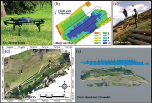
Mapping of Landslides in the Village of Ricasoli (Tuscany). From Rossi et al. (2018).
